New York - resort?
I took my annual summer resort vacation...in New York City! Now many folks wouldn't think of New York City as a resort and certainly not as a summer resort. But for most of its history, New York was precisely that - especially for the poor and middle class that make/made up so much of the city's populace. Why? Because they couldn't afford the time or the money to reach out to the numerous lakes in the mountains north of town or the expansive beaches of eastern Long Island. Nope, hundreds of thousands made do with the likes of the Bronx's Orchard Beach and City Island. The trolley and later the subway brought droves to Brooklyn's Coney Island, Manhattan Beach, Plum Beach, and Brighton Beach. Sheepshead Bay (it looks like a sheep's head from the air) offers deep-sea fishing at a reasonable price. And the prime resort area remains the Rockaways. Queens's seven mile-plus stretch of sand from Far Rockaway to Rockaway Point with views of New Jersey's Atlantic Highlands provides some of the finest beaches on the east coast.
Some work - some play
Although I was in Rockaway, this year my resort activity was somewhat curtailed. I was under a deadline to get the edited manuscript of The Cavalier Spy reviewed and back to the publisher (done). So my summer fun in the sun was restricted to a one day visit to the beach. However, I took advantage of a special deal set up by NYC as a result of Hurricane Sandy. Because of Sandy's impact on mass transit in the Rockaways, the city contracted a fast boat to go from Beach 108th Street and Jamaica Bay around the end of the Rockaways and up New York bay to lower Manhattan. Readers of The Patriot Spy know Manhattan was called The Island of New York during the time of the American Revolution. The trip takes an average of 38 minutes each way for the round trip cost of $4! Like that, badabing, you are staring up at the lofty buildings of New York's financial district. So what the heck does this have to do with the American Revolution? Well, the boat ride passed many of the critical points of the British invasion of New York back in the summer of 1776.
Sailing into the past
 |
| British cross the harbor towards Gravesend Bay |
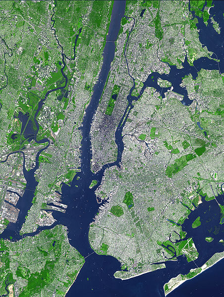 |
| The Sea Streak sails from the Rockaway peninsula on the lower right and up the harbor to the lower extreme of Manhattan. Note the narrows and Governors Island. The Sandy Hook is just off the bottom of the photo, |
The final heading
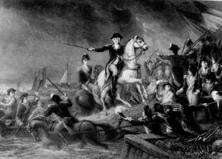 |
| The Gloucester Regiment evacuates Washington's army from its defenses near the Heights of Brooklyn |
The (old) City of New York
We arrived at lower New York, which during the time of the Yankee Doodle Spies extended not too far beyond today's Wall Street. We landed in the lower central portion of this image of early colonial New York. Note how the city abruptly ends at the Wall Street, it extended past Chambers Street by the mid-1700s.
Pearl Street was a contemporary thoroughfare about a half-mile north of where we landed. It probably looked little different from this image from the Dutch era, although the docks and buildings would be more extensive as the city had grown. I will do a future blog on some of the revolutionary war era sites that still remain in the city. Of course, the march of history (not progress) has limited them to only a few.
 |
| Dutch-style buildings still dominated New York during the time of the Yankee Doodle Spies |
I
No comments:
Post a Comment