Followers

Showing posts with label Brooklyn. Show all posts

Wednesday, August 24, 2016

The Battle Pass

I guess this could also be considered a "place" as well. But the place was the location of today's Prospect Park in Brooklyn, New York. To make things more complicated, it was known as the Flatbush Pass at the time. It was the linchpin in the American outer defense ring on Long Island, a battle that took place during this week in August 1776. The good news is you can still visit the Battle Pass, which is now a 526-acre oasis amidst Brooklyn's sprawl. This week marks the anniversary of the events leading up to the critical Battle of Long Island - America's first battle as a nation. I thought a blog post focusing on one aspect of this Revolutionary War battle would be fitting.


The Flatbush (Battle) Pass 1776


The Original Ground Zero 


The Flatbush Pass was a crucial piece of terrain in the outer defenses on Long Island. Most of his troops were frantically building a series of earthworks and small redoubts from Wallabout Bay to Gowanus Creek in an effort to protect the village of Brooklyn and the ferry point below the famous heights of that name. Recognizing British superiority in numbers and equipment, General George Washington relied on a Breed's Hill-style defense that would inflict losses on the British, similar to what the rebel army did outside Boston the previous year. 

However, the advantages of holding the British at the "great Moraine" were too tempting to ignore. The moraine, then known as the Heights of Guan, was the southern edge of the glacier from the last great ice age. When the glacier receded, it left a rugged strip of land across the normally flat terrain of Long Island, running from southwest to northeast. Although only about 100 feet above sea level, the Heights of Guan formed a formidable barrier, only passable through three passes. The central one was the Flatbush Pass.


The Great Moraine dominated the terrain of Long Island


While the British executed a night envelopment via the Jamaica Pass to the east, the British commander in chief, General William Howe, launched two holding attacks to pin the Americans
defending the other two passes. One of some 7,000 men under British General Grant struck near today's  Greenwood Cemetery in an attempt to force the Martense Road.


General von Heister 's force struck the
Flatbush Pass


But the center attack at Flatbush Pass almost made the British encirclement unnecessary. It was mainly composed of Hessians under the command of German General von Heister. The Hessians struck the pass. When they realized the situation was hopeless, most of the approximately 1,500 American defenders abandoned their posts and headed to the safety of the main defenses near Brooklyn. 

The brave American commander at the pass, General John Sullivan, tried to hold his position, but as panic spread, he and his men had to fight their way out. The large and determined enemy trapped him and what remained of his forces at Baker's Tavern (near today's Fulton and Flatbush Avenue). The veteran of Boston and Quebec, brave but headstrong, was cut off from his men and became one of two generals captured on Long Island that fateful day.


American General John Sullivan captured
near the Flatbush Pass


The Place Today


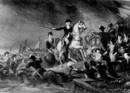
Defenders on Long Island fought desperately against all odds


The site of the Battle Pass is just north of the Prospect Park Zoo.


Battle Pass Marker


The Maryland Monument still stands at the south-central part of the park, nestled between Prospect Park Lake and Lookout Hill. The monument honors the brave fight by the First Maryland Continental Line, who courageously battled the British against all odds. I will save the story of the Maryland 400 for another post (actually, I have already posted about it).


The Maryland Monument


Site of the Dongan Oak - a huge tree felled to block the Flatbush Pass


There is a Quaker Cemetery near Lookout Hill that dates back to the 17th century. The Lefferts Homestead was located at Empire Boulevard and Flatbush Avenue. The original Dutch colonial farmhouse was accidentally burned by American defenders. The owner, Peter Lefferts, rebuilt the house during the latter part of the war using some of the original wood. In 1918, the family donated the residence to the city, and it was moved to Prospect Park from its original site at 563 Flatbush Avenue.


Restored Lefferts House


On a beautiful summer day, Prospect Park is filled with thousands of visitors walking, riding, visiting the zoo, or lounging by the lake. As Brooklyn experiences a kind of renaissance, the park and its lush greenery offer an ideal place to enjoy a touch of nature. But almost none of today's visitors know about the drama and tragedy that unfolded in the heart of their oasis.


Few visitors to Prospect Park today realize
they are on Hallowed Ground


Sunday, August 25, 2013

The Red Lion Inn

Most Americans are familiar with the American Revolution in New York. Still, even fewer are aware of the war on Long Island, which in 1776 encompassed the area on Long Island today known as Brooklyn. Sadly, those who actually live in the "How Sweet it Is" borough (also known as Kings County) may know the least.  History is ultimately about people and places, yet most Americans know little of their local history. I confess to sometimes falling into that category.  I blame the localities, not the schools, for failing to properly celebrate themselves.  Okay - rant over. Time to discuss a place, specifically a building, that was center stage for a few hours during the largest battle in the American War for Independence.


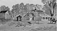
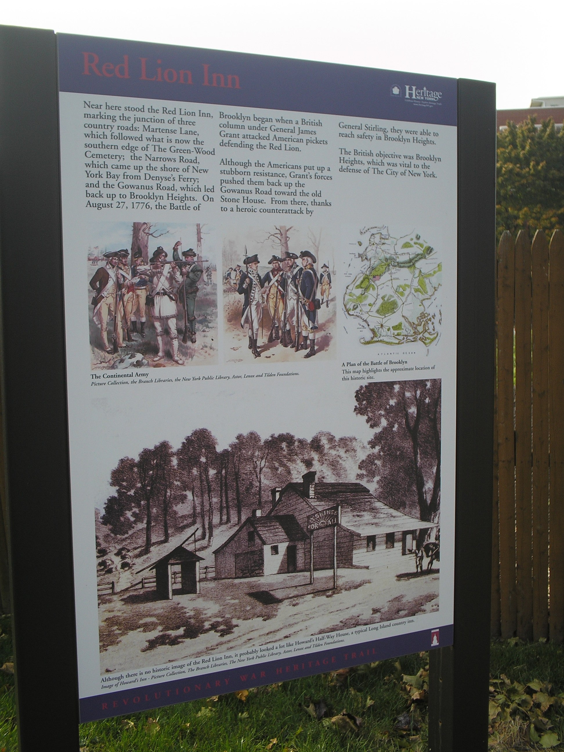
There is no existing image of the Red Lion Inn.
The building itself is Howard's Tavern located at the Jamaica Pass
Both were half-way houses.


The Tavern


The Red Lion Inn was named after the tavern where English King Henry V rested after defeating the French at the Battle of Agincourt. It is fitting that the first action in the first major British victory of the American Revolution took place near the inn. The Red Lion Inn was located at the junction of three country roads: Martense Lane, which followed what is now the southern edge of Green-Wood Cemetery; the Narrows Road, which came up the shore of New York Bay from Denny’s Ferry; and the Gowanus Road, which led back up to Brooklyn Heights. This area is roughly 39th Street and 3rd Ave. in Brooklyn, although other accounts place it on 4th and 40th. I refer to Mark M. Boatner's "Landmarks of the American Revolution" as my guide. Boatner states that many battle markers in Brooklyn are imprecise, and I agree. You can read an earlier blog of mine about my personal visit to that part of Brooklyn a few years ago.


The passes and the British flank march around the Americans.
The Red Lion lay along the Flatbush (western-most)
pass on the left


The Action 


Gen James Grant
On August 27, 1776, the Battle of Brooklyn started when a British column led by General James Grant attacked American pickets defending near the Red Lion Inn. Some accounts say the British were foraging for melons when they startled a rebel picket. It was in this, the westernmost pass, that American Major General William Alexander, a Jersey native also known as "Lord Stirling," stood with the largest force defending the Heights of Guan. The British commander was General James Grant, a Scotsman known for his stout heart and physique. Grant hated rebels and urged his men forward with a ferocity rarely seen from the British. His column of about five thousand professionals rolled into the pass, thirsting for action. But Lord Stirling managed to organize some of the Americans into a line of battle on a piece of high ground just off the Gowanus Road. He was joined by a two-gun artillery battery that covered the road. Grant's troops formed into battle lines—creating maximum volley fire at the front—and advanced up the road. This was perhaps the first open-field battle of the war. Stirling held a strong position, and the initial British assault was repelled by American musket fire and cannon shots. Grant then brought up some of his guns and bombarded the American position. His goal was to pin the Americans while a larger part of his forces completed their envelopment. Later, Grant sent a force to the left of the road, but Stirling countered with a detachment that stopped the British.


Lord Stirling


The  Finale


From 7 to 11 a.m., the Americans resisted stubbornly, but eventually, Grant’s forces pushed them back up the Gowanus Road toward the old Stone House. From there, thanks to a heroic counterattack by Lord Stirling, the remaining Americans managed to reach safety in Brooklyn Heights, the British objective, which was crucial for defending The City of New York. Stirling led 400 men from the Maryland and Delaware Continental Line in several frontal assaults on the British troops who had outflanked the defenders and now blocked their way. All but nine were killed, wounded, or captured in the fight. From those Heights, George Washington watched one-third of his force get wiped out. This is the pivotal event in my novel, The Patriot Spy.


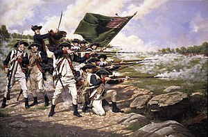
Delaware Regiment on Long Island


A Factor?


The Red Lion Inn was not a factor in the battle, unlike the Old Stone House. However, it served as an important landmark. During a time when maps were scarce and often inaccurate, this was significant. Orders frequently referenced landmarks such as bridges, mills, taverns, or farms. Consequently, accounts from both sides mentioned "the Red Lion" or "the Red Lyon" to describe their locations during certain phases of the battle. One might imagine a sign hanging out front showing a red lion, since many taverns used visuals at a time when most men could not read.


Marker at Greenwood Cemetery commemorating
action near the Red Lion Inn (note: Howard's Tavern is the visual)

Saturday, July 13, 2013

How I Spent My Summer Vacation

New York - resort?


I took my annual summer resort vacation...in New York City! Now many folks wouldn't think of New York City as a resort and certainly not as a summer resort. But for most of its history, New York was precisely that - especially for the poor and middle class that make/made up so much of the city's populace. Why? Because they couldn't afford the time or the money to reach out to the numerous lakes in the mountains north of town or the expansive beaches of eastern Long Island. Nope, hundreds of thousands made do with the likes of the Bronx's Orchard Beach and City Island. The trolley and later the subway brought droves to Brooklyn's Coney Island, Manhattan Beach, Plum Beach, and Brighton Beach. Sheepshead Bay (it looks like a sheep's head from the air) offers deep-sea fishing at a reasonable price. And the prime resort area remains the Rockaways.  Queens's seven mile-plus stretch of sand from Far Rockaway to Rockaway Point with views of New Jersey's Atlantic Highlands provides some of the finest beaches on the east coast.


Some work - some play


Although I was in Rockaway, this year my resort activity was somewhat curtailed.  I was under a deadline to get the edited manuscript of The Cavalier Spy reviewed and back to the publisher (done). So my summer fun in the sun was restricted to a one day visit to the beach. However, I took advantage of a special deal set up by NYC as a result of Hurricane Sandy.  Because of Sandy's impact on mass transit in the Rockaways, the city contracted a fast boat to go from Beach 108th Street and Jamaica Bay around the end of the Rockaways and up New York bay to lower  Manhattan. Readers of The Patriot Spy know Manhattan was called The Island of New York during the time of the American Revolution. The trip takes an average of 38 minutes each way for the round trip cost of $4! Like that, badabing, you are staring up at the lofty buildings of New York's financial district.  So what the heck does this have to do with the American Revolution? Well, the boat ride passed many of the critical points of the British invasion of New York back in the summer of 1776.


Sailing into the past


British cross the harbor towards Gravesend Bay


As the boat eased out of Jamaica Bay and turned into New York's impressive lower harbor, I could look to the southwest and see Sandy Hook, New Jersey. But back in 1776, the Sandy Hook included a sand bar that blocked the lower harbor, preventing large British warships from crossing over it except during extreme high tide. A few minutes later we were approaching the Verrazano Narrows. The British went through the narrows and landed an army of twenty-four thousand or so on Staten Island, then a Tory stronghold. After recovering for a few weeks they launched barges and longboats across the narrows and landed troops at Gravesend Bay. This was on my right (starboard side) just before I reached the narrows, not far from today's Fort Hamilton. The few American defenders there ran off at the sight of the British. We continued on another ten minutes with Bayonne on our port and Bay Ridge, then Red Hook, on our starboard. Near Red Hook is the Gowanus Canal: the remnant of the Gowanus Creek that played such a critical role in Washington's defenses on Long Island. The boat soon approached Governor's Island, where the Royal Governors resided during colonial times.  The last  Royal Governor of colonial New York, nasty William Tryon, evacuated a year earlier but returned in 1776 with the British armada.


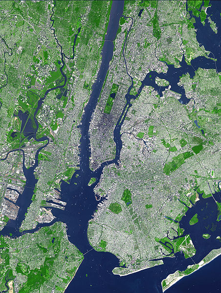
The Sea Streak sails from the Rockaway peninsula on the lower right and up
the harbor to the lower extreme of Manhattan. Note the narrows and
 Governors Island. The Sandy Hook is just off the bottom of the photo,


The final heading


The Gloucester Regiment evacuates Washington's army from its defenses
near the Heights of Brooklyn
Passing the narrow channel between Governor's Island and Brooklyn, the boat entered the waters of the lower East River. To our starboard front lay Brooklyn Heights, just south of the famed Brooklyn Bridge. This was the location of Washington's headquarters during the battle for Long Island, and the point from which the Gloucester seamen evacuated the beleaguered army on a stormy night with the British front lines not more than a few hundred yards distant! The crossing from Brooklyn to New York was considerably wider than it is today, as the Manhattan's expansive use of landfill has narrowed the river by almost a quarter-mile.


The (old) City of New York


We arrived at lower New York, which during the time of the Yankee Doodle Spies extended not too far beyond today's Wall Street. We landed in the lower central portion of this image of early colonial New York. Note how the city abruptly ends at the Wall Street, it extended past Chambers Street by the mid-1700s.


Pearl Street was a contemporary thoroughfare about a half-mile north of where we landed. It probably looked little different from this image from the Dutch era, although the docks and buildings would be more extensive as the city had grown. I will do a future blog on some of the revolutionary war era sites that still remain in the city.  Of course, the march of history (not progress) has limited them to only a few.

Dutch-style buildings still dominated New York during the
time of the Yankee Doodle Spies


I

Thursday, May 23, 2013

A Yankee Doodle Memorial

This is Memorial Day weekend.  For most Americans, just another reason to have a party, go to ball games or watch the Indianapolis 500 or Preakness.

But for some, especially those who have a military connection, Memorial Day is truly something special because it is the one day that commemorates those who have fallen in the service of their country. Memorial Day was promulgated on 5 May 1868 by General John Logan, the Commander of the Grand Army of the Republic, a Civil War veterans group made up of northern vets -sort of the American Legion/VFW of its day. To honor Civil War fallen, flowers were placed on the graves of Union and Confederate dead on 30 May although most southern sympathizers clung to separate holidays to commemorate their fallen. This changed after World War 1 when veterans of both regions who had served side by side began to be honored as well.


General John A. Logan


The trauma of the Civil War, followed by that of the Great War brought industrial age carnage to new heights and the need for some sense of spiritual closure for those fallen in massed attacks such as those at Gettysburg, Cold Harbor, or the Marne and the Meuse-Argonne offensives.  To honor them, huge cemeteries and memorials span the nation and the battlefields of Europe and Asia honoring the hundreds of thousands of fallen. By "modern" standards casualties during the War for Independence were laughable and most soldiers died from sickness and starvation while in service to their nation.


But our First Patriots cherished and honored their fallen no less. And after the war, the need to honor those who gave all for an idea sanctified both the idea and those whose sacrifice enabled it.  Here are just a few examples:


General Montgomery Memorial
at St. Paul's
The first commemoration was ordered by the Continental Congress in 1776 to honor General Richard Montgomery, who fell during the American assault on Quebec, Canada. Our first fallen general's monument was designed and built under the supervision of Benjamin Franklin by one of France's best artists, King Louis XVI's personal sculptor, Jean Jacques Caffieri. Shipped to America upon completion, it rested in Edenton, NC.  Although Congress originally intended to place it in Philadelphia, it ultimately ended up in
New York City, where, in 1788, it was installed under the direction of France's Pierre Charles L'Enfant (who later designed Washington, DC)  beneath the portico of St. Paul's Chapel, which served as George Washington's church during his time in New York as the United States' first president in 1789, and where it remains to this day. Montgomery's body, which was originally interred on the site of his death in Quebec, was moved to St. Paul's in 1818.


Those who read my earlier blogs also know that I began the Yankee Doodle Spies idea, and particularly The Patriot Spy because as a boy I was inspired by the Maryland Monument in Brooklyn's Prospect Park (scroll down to read of it). But an important and little known monument was erected at the site of the Brooklyn Navy Yard.  Why? Because there the remains of perhaps as many as 15,000 First Patriots were interred there.  These were prisoners of war, the victims of the notorious British prison ships anchored as "hulks," that is de-masted sailing ships, docked in an area called Wallabout Bay.  These First Patriots later became known as the "Prison Ship Martyrs."


Unveiling Prison Ship Memorial at Ft Greene Park 1908


For years after the war, the bones of Martyrs would wash up on shore and finally  a monument was erected near the site of the hulks at the famed Brooklyn Navy Yard at a place called Vinegar Hill.  In the mid 19th century a stone crypt was erected at nearby Fort Greene Park and the bones were interred there. Fort Greene was one of several forts erected by Washington to defend Brooklyn from the British in 1776 (you can read about that in The Patriot Spy). In the late 19th century the martyrs' remains were once again moved to a new Fort Greene monument  - a tall (148 foot) obelisk that looked down on Brooklyn. When President Taft dedicated it in 1908, it was one of the finest structures in the nation and a fitting final resting place for the Prison Ship Martyrs.


General Wooster Monument

One of my recent blogs was on Connecticut's General David Wooster who was killed in the fighting that followed the British/Loyalist raid on the arsenal at Danbury, CT. On June 17, 1777, Congress voted that a
suitable monument should be erected in his memory, but measures were never inaugurated to execute the resolution. His grave was not identified until 1854 when the Connecticut legislature laid the cornerstone of a monument. Today, a monument 30 feet high marks his final resting place at Mount Moriah in Danbury. Coincidentally, Wooster fought at Quebec as Montgomery's second in command and took much unjust blame for the campaign and its result.


Many argue that Philadelphia, our nation's first capital, marks the spiritual, political, and geographic center of the American War for Independence and in 1954 an impressive monument was built to commemorate those who fell in the war. The Tomb of the Unknown Revolutionary War Soldier is  located in
Philadelphia's Washington Square. It honors the thousands of soldiers who died during the American Revolutionary War, but especially those who were buried in mass graves in that park.
The actual  plaque upon the tomb of the Unknown Soldier reads: "Beneath this stone rests a soldier of Washington's army who died to give you liberty."

Tomb of the Unknown Revolutionary War Soldier
Philadelphia

Bunker Hill Monument
Boston
If Philadelphia was the heart of the new nation, Boston was the heart and soul of the rebellion that forged the nation. The entire area is a virtual monument to the American Revolution but I'll single out one for this piece - the Bunker Hill Monument. The battle of Bunker Hill (which took place on Breed's Hill) is legendary, and for years General Washington (vainly) sought to replicate the scenario of entrenched Americans mowing down disciplined British troops who calmly marched into a hale of rebel lead. The first monument on the site was an 18-foot wooden pillar with a gilt urn erected in 1794 by King Solomon's Lodge of Masons to honor fallen patriot and mason, Dr. Joseph Warren. In 1823, a group of prominent citizens formed the Bunker Hill Monument Association to construct a more permanent and significant monument to commemorate the famous battle. The existing monument was finally completed in 1842 and dedicated on June 17, 1843, in a major national ceremony. The exhibit lodge was built in the late nineteenth century to house a statue of Dr. Warren.


So this weekend and throughout the year, we should remember all Americans who died in their nation's service. But we should especially recollect those who died to establish the nation and the idea of a free and independent people. Wherever and however you decide to celebrate the occasion, take a moment to think of those who had no Arlington - the fallen at Saratoga, Brandywine, Brooklyn, Harlem, Paoli, Bennington, Germantown, Charleston, King's Mountain, Guilford Court House, Valley Forge, Yorktown, and hundreds of battlefields fields so small only the local patriots know of them. Give them a roaring "Huzzah" for duty well done.

Arlington

Friday, November 9, 2012

The Cortelyou House

The House

This edition of the Yankee Doodle Spies highlights the Vechte-Cortelyou House in Brooklyn, New York, the site of the high-water mark of the Battle of Long Island.

"Here on the 27th of August, 1776, Two hundred and fifty out of four hundred brave Maryland soldiers, under the command of Lord STIRLING, were killed in combat with British troops under CORNWALLIS."
...Inscription on a plaque commemorating the action near the Vechte-Cortelyou House, now called the Old Stone House.


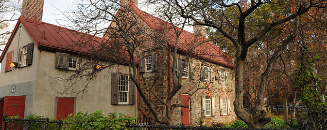
Frontal View of the House today


The Vechte-Cortelyou House in Brooklyn, New York, was built in 1699 by a Dutch settler named Claes Arenston Vechte. Vechte and his family worked the land, farming the neat fields and grazing animals in the verdant pastures of this rich farmland.  They also gathered oysters and other bounty from the nearby Gowanus Creek, which they used to ship their produce to Manhattan.  Around the time of the revolution the land was leased to the Cortelyou family, and one of them later purchased the property.  The simple architecture is classic Dutch colonial with a mixture of stone and mortar, steep tiled roof and a wood shingled appendage (what we might today call a "bump-out") that appears to function as the kitchen.

Major General Cornwallis

The house was situated near the intersection of today's 3rd Avenue and 5th Street in Park Slope. During the events leading up to the cataclysmic fight that took place there, the house served as the headquarters of William Alexander, who called himself "Lord Stirling," because of a claim to that Scottish peerage.While holding the passes south of the house, Lord Stirling found his army surrounded when Major General (himself a Lord) Cornwallis' force of several thousand seized the area around the house after a night march down the Jamaica Road into the unguarded east flank of the American Army. 


Lord Stirling


While he ordered most of his forces to attempt escape across the Gowanus Creek, Lord Stirling led some 400 hundred Continental Line from Maryland and Delaware against the British defending near the Old Stone House, which they had turned into a strong defensive position. Stirling led six assaults against the British at that location and around 250 Americans were killed there and are buried nearby (see my earlier blog on trying to find them entitled "On Hallowed Ground").  The importance of this battle is fully described in The Patriot Spy, and the fictional events that I added form the genesis of the Yankee Doodle Spies.
Thumbnail for version as of 09:46, 25 August 2011

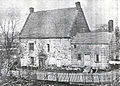
The Original House


Interestingly, in the 19th century the original house once served as the headquarters of the Brooklyn baseball club that later became the famed Brooklyn Dodgers. You can see from this photograph the once prosperous farmstead had by the latter 19th century fallen into disrepair. 

Back View of The Old Stone House Today


The original Cortelyou House was later torn down but a reconstruction was built from dug up debris and replica materials and can be found in J.J. Byrne Park in the Park Slope section of Brooklyn. It serves as a museum that celebrates the events of August 1776 that took place on the hallowed ground around it. 
Sadly, little of the feel or look of the times can be found there.  However, nearby Prospect Park and Greenwood Cemetery do present views that might have been "enjoyed" by Lords Stirling and Cornwallis back in August of 1776.
As you can see, the reconstructed house is smack in the heart of a major urban area.  Note the Gowanus Canal, the remains of the Gowanus Creek, not too far distant. 

Where in the world is the Cortelyou House?

Saturday, September 1, 2012

On Hallowed Ground


In an earlier post, I talked about the origins of setting The Patriot Spy during the Battle of Long Island. Several times while writing the book, I revisited the neighborhoods involved in the battle. Some of these were neighborhoods I had lived in long ago, like Park Slope and Flatbush - both in the heart of Brooklyn.

On one of my return trips, I went to the place I believed was the site of the pivotal point of the battle – the forlorn hope attack by the brave Marylanders and their brothers in arms from Delaware (who are actually depicted on the cover of The Patriot Spy). It was a gray autumn day. We drove to the intersection of 3rd Avenue and 8th Street in Park Slope – the spot where I thought the fallen 300 from the engagement had been laid to rest.  


There, in front of an auto repair shop, I stood looking at an old building across the street. Surrounded by scaffolding, it was clearly in the process of being demolished. A large, burly guy with a thick gold necklace saw me standing there and came out of the repair shop.

“Can I help you?” He asked, more as a challenge than a question, with a thick Brooklyn accent.
“I’m looking for a marker,” I replied.  One of the sourcebooks I used indicated the existence of a small marker on the side of a building.
“A marker?  Marker for whad?”  He asked with a really puzzled look.
“Almost three hundred  Americans died here and are buried in a mass grave,” I answered.
“Died? When?  How? Who done it?” He looked stunned and puzzled, and this being Brooklyn, likely thought this had something to do with the mob. 
“There was a great battle here in 1776.  Almost three hundred patriots were killed fighting the British and are supposed to be buried near here.”
He nodded his head knowingly. “Oh yeah, well, I ain’t never seen no marker, but it wuz probably on dat building.”

I looked across the street at the building, now wrapped in scaffolding and plywood, surrounded by a chain-link fence. I decided my search was over.  

I share this story to draw readers' attention to a recent article in the New York Times about a Brooklyn historian named Bob Furman. Furman is working to identify, preserve, and properly commemorate important sites on the battlefield. The article is worth reading because it highlights the difficulties of maintaining a sense of history amid urban growth.

Gowanus Canal


More than a hundred years ago, a growing city’s demand for residential and industrial land overwhelmed the area. It’s hard to believe that this densely developed part of New York was once filled with beautiful farms, fields, orchards, and woods. It’s also hard to believe that brave and gallant men once fought desperately for their lives and their new nation on these busy streets. Let's hope Furman and his team at the Brooklyn Preservation Council succeed in reclaiming some of this sacred ground. Sadly, most remnants of the Revolutionary War battle and the terrain where it was fought are now gone.

Sunday, July 29, 2012

Why New York?


The Maryland Monument,
Prospect  Park


Why New York?  This is one of the first questions I get when I discuss the Yankee Doodle Spies series and more importantly, the first book in the series, The Patriot Spy.  It is a good question and the answer is simple:  I am from New York.  Indeed, most folks (including New Yorkers) consider the events near Boston as the natural beginning of the revolution - and they are right.  Lexington and Concord, the siege of Boston, the battle at Bunker/Breeds Hill demonstrated that the colonies could field an army.  But they had done so before - colonial forces were not inconsiderable in the wars against the French and the Indians during several wars in the early 18th century. However, the revolutionary forces assembled in Cambridge, Massachusetts in 1775 stood for freedom from what they viewed as royal tyranny and the infringement of their rights as Britons.  Essentially, this was the view of the Whig Party on both sides of the Atlantic.

One day when I was about seven or eight, my dad took me to Brooklyn's Prospect Park where we saw the park's moving monument to the Maryland Continental Line in the Battle of Long Island.  My dad gave me a long (so it seemed to a young boy) rendition of the battle and the gallantry of those infantrymen. At the time my dad was commander of A Company, 2-69th, New York.  The "Fighting 69th" is a famed infantry unit that is still a component of the New York Guard and part of the 42d Infantry Division, the Rainbow Division.

I digress.  My dad focused my attention on the ragged lines of men who had never seen battle, serving a new nation, who now had to charge against a "thin red line" of highly trained British professionals. The Marylanders, essentially destroyed, saved the new American Army. My dad ended his story with words to the effect of  "and so now each year the Maryland Guard places a wreath at the monument marking the gallantry of one its first units."

For whatever reason, his words echoed in my memory for many decades, even as so many of my other memories have faded.  I am not sure if the Maryland Guard still places a wreath at the monument each year. So when I wrote the first book of this series, I decided to make it a lasting "wreath" to the men from Maryland and to infantrymen everywhere.